

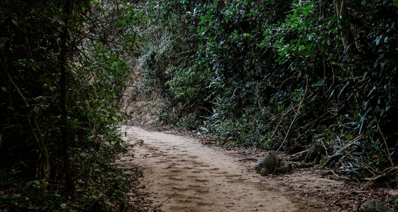
Hiking in Vieques Island, Puerto Rico
Best Hikes + Walks on Vieques
There’s a side of Vieques you only really notice on foot: birds calling from the trees, tiny lizards disappearing into the leaves, and paths that suddenly open onto a stretch of blue water.
Some outings are proper hikes, with rocky climbs and a little effort involved. Others are beach walks that become longer than you intended because you keep wondering what’s around the next bend. Both belong on your itinerary.
Start early, bring water, and give yourself time to enjoy the journey. On Vieques, the walk to the beach can be just as memorable as the beach itself.
Playa Negra Trail
Best for: A short adventure with a beautiful beach payoff.
Plan for: Approximately 20 minutes each way, plus time exploring the shoreline.
Probably the most famous walk on Vieques, Playa Negra makes you work just enough to appreciate the arrival.
The approach follows a sandy streambed through vegetation toward the coast. There’s something lovely about the gradual transition: trees overhead, patches of damp sand underfoot, and then the shoreline opening in front of you. TICATOVE describes the route as approximately half a mile each way. ticatove.org
At the beach, dark mineral sand mixes with lighter sand in streaks, swirls and shifting bands. Don’t expect the entire shoreline to look uniformly black. Rain, runoff and wave action change how much dark sand is exposed, so the beach can look different from one visit to the next. Vieques
This is a wonderful place to slow down and look closely. Photograph the patterns where the colors meet, walk a comfortable stretch of shoreline, and leave the sand where it belongs.
What to expect underfoot: Sand, uneven ground and potentially wet or muddy sections. The approach is a streambed, so shoes that can get wet are useful. After heavy rain, reconsider the outing rather than assuming a short walk will be an easy one. Vieques
Our suggestion: Bring a small towel and a bag for muddy shoes. Give yourself enough time to enjoy the beach without rushing back.
Good to know: Swimming is a separate decision from hiking. Assess the waves and your ability to enter and exit safely once you arrive. If the stream is flowing strongly or storms are approaching, save the walk for another day.
Punta Arenas Walk
Best for: A relaxed shoreline outing, coastal photography and a slower island day.
Plan for: A short stroll or a longer out-and-back walk—you choose the turnaround point.
Punta Arenas is more of a scenic beach walk than a traditional hike, and that’s part of its appeal. There’s no summit to reach and no need to turn it into a mileage goal. Pick a comfortable stretch of shoreline and enjoy being on the western edge of Vieques.
On a calm day, the water can be beautifully clear, with changing shades of blue and green along the shore. On other days, wind, waves or recent rain may give it a completely different character. Come for the coastline rather than a promise of perfect conditions.
Walk slowly enough to notice the details: the shape of the trees, movement along the waterline, and the way the coast changes as you move farther from your starting point. If horses are nearby, give them space and enjoy watching from a distance.
What to expect underfoot: Conditions vary along the shoreline. Choose your route around the actual sand, rocks, vegetation and water level you encounter. Don’t assume you can continue indefinitely around a point.
For families: Choose a short turnaround point before setting out. An easy beach stroll becomes less enjoyable when everyone realizes the car is farther away than expected.
Our suggestion: Bring walking shoes even if you plan to spend part of the visit barefoot. Keep a second supply of drinking water in the vehicle for afterward.
About sunset: The west-facing setting makes late-day light especially appealing, but Punta Arenas is inside the wildlife refuge. Check current gate hours and leave time to drive out before closing. Plan the visit around those hours rather than assuming you can stay until dark. U.S. Fish & Wildlife Service
Monte Pirata / Mount Pirata
Best for: Walkers looking for a steeper outing and elevated island scenery.
Plan for: Confirming the authorized route and starting point before estimating distance or time.
Monte Pirata brings a different landscape into a Vieques hiking day. Rising to nearly 1,000 feet, it is the island’s highest point, with forest habitat that contrasts with the exposed coastline and beach paths many visitors know best.
TICATOVE’s observation-platform project describes mature forest, viewing facilities and work toward improved public access. However, its project page contains older updates, so it should not be treated as confirmation that every road, trail or summit area is currently open. TICATOVE
Before heading out, ask refuge staff which public route is available, where you may park, and whether the walk uses a paved road, a forest trail or both. That distinction matters: your starting point determines how much climbing and walking the outing involves.
What to expect: Prepare for sustained uphill effort rather than judging difficulty by distance alone. Humidity can make a climb feel much harder, and the downhill return deserves time and attention too.
Bring: Supportive shoes, water, a snack, sun protection and a downloaded map. Keep your hands free on uneven sections.
Our suggestion: Choose a comfortable turnaround time before you start. Reaching a particular viewpoint is optional; getting back comfortably is part of the plan.
Important: A route appearing on AllTrails or Google Maps does not establish public access. Follow current signs and never bypass a gate or closure. If you cannot confirm the route, choose another hike that day.
Novillo Trail
Best for: A longer nature outing with the option to explore a coastal connection.
Plan for: Approximately 45–50 minutes each way for TICATOVE’s described Novillo route, plus stops.
Novillo is a good choice when you want the walk itself to be a substantial part of the morning.
TICATOVE places the trailhead at the first parking area on the approach to Puerto Ferro Lighthouse. Its guide describes moderate hiking with some short bypasses and an optional connector toward Pirate’s Cove. The published opening update dates to December 2023, so check current conditions and signs before setting out. ticatove.org
Give yourself time to notice the landscape rather than treating the route as transportation to the water. Pause to listen for birds, look for movement in the vegetation, and enjoy the change of pace that comes with spending a little longer on foot.
What to expect: Walking shoes, sun protection and a realistic return plan matter here. Beach stops and photography can add considerably to the published walking estimate.
About the Pirate’s Cove connection: The linked route combines destinations, so don’t assume its total distance is the same as the Novillo walk alone. Confirm which route you intend to follow before leaving the parking area.
TICATOVE separately describes a Pirate’s Cove approach from the second lighthouse-road parking area, taking approximately 20–30 minutes each way. Connecting the two outings requires additional planning. ticatove.org
Our suggestion: Start with an out-and-back plan. Add the connector only if you understand the route and everyone has enough water, energy and time.
Puerto Ferro Lighthouse Walk
Best for: Dramatic coastal scenery, photography and a short walk with a sense of history.
Plan for: A short approach, followed by unhurried time in the permitted viewing areas.
The Puerto Ferro Lighthouse is one of those places where the setting does much of the storytelling. Weathered ruins, low coastal vegetation and an open sweep of sea give the headland a striking atmosphere.
The lighthouse began operating in 1896 and was abandoned in 1926. Today, the building is a ruin, with the surrounding coast providing much of the experience. Puerto Rico Day Trips describes an approximately quarter-mile approach from the parking area, exposed to sun and heat. PRDayTrips
It’s less about completing a demanding hike and more about taking time to appreciate the place. Look back along the shoreline, notice the textures of the old structure from outside protected areas, and enjoy the contrast between the building and the sea.
What to expect: A short walk can still feel hot here. Bring water, a hat and shoes with grip.
Our suggestion: Visit early in the refuge’s opening hours for a cooler outing and appealing morning light. If you go later, keep enough time for the walk back and drive to the exit.
Good to know: This is not a place to climb ruins or approach cliff edges. The coastal rock can be crumbly, and the building has deteriorated. Stay back from drop-offs and respect barriers. PRDayTrips
About sunrise and sunset: Check refuge access hours first. The lighthouse is not an unrestricted dawn-to-dark destination, and photography plans need to fit the posted gate schedule.
Playuela Loop / Cerro Playuela Trails
Best for: A more varied hike with climbs, coastal viewpoints and beach options.
Plan for: Approximately two hours to explore the full system described by TICATOVE, allowing longer for extended stops.
One of my personal favorites.
The Cerro Playuela trails offer a little of everything that makes walking in Vieques rewarding: changing vegetation, rocky climbs, glimpses of blue water and the possibility of finishing part of the outing beside a quieter stretch of coast.
Think of this as a branching trail system rather than one simple loop with a single destination. TICATOVE describes three branches leading toward a viewpoint across Puerto Ferro to the lighthouse, a small beach near the bay outlet, and the western end of Playuela. Its guide estimates approximately two miles to explore the whole system. ticatove.org
Choose your version before setting out. You might focus on a viewpoint, make a beach your turnaround point, or explore more of the system if conditions and energy allow. Checking the map at each junction helps keep a pleasant outing from becoming an unexpectedly long one.
What to expect underfoot: Ascents and descents over rock and gravel. Wear shoes with traction and take your time on loose sections. This is a good outing for people who enjoy hiking beyond a flat beach approach. ticatove.org
Our suggestion: Hike first and keep beach time as a flexible second activity. Carry what you need for the walk without loading yourself down with an entire beach setup.
A useful distinction: The shorter Playuela beach-access trail and the Cerro Playuela hill trails are different outings. Make sure the trailhead and map match the experience you want.
What to Bring
A few basics make these walks much more enjoyable:
- Water: Carry enough for the route, breaks and possible delays. Keep extra for afterward.
- Real shoes: Sneakers or trail shoes for rocky paths; secure footwear that can get wet for suitable streambed approaches.
- Sun protection: A hat, sunscreen and lightweight coverage.
- Snacks: Especially if hiking with children or adding beach time.
- Insect repellent: Useful around vegetation and wetland areas.
- A downloaded map: Save it before leaving reliable service.
- A charged phone: A small power bank helps on longer outings.
- A rubbish bag: Pack out everything you bring.
- A towel: Because there is a very good chance the day will involve sand or saltwater.
A Few Important Hiking Notes
Short doesn’t always mean easy. Heat, humidity and uneven footing can turn a modest distance into a surprisingly demanding outing. Start early and leave room for breaks.
Trail marking and maintenance vary. Some routes have signs; others require more attention. Confirm the route before you walk and turn back if you lose it.
Check the ground after rain. Yesterday’s weather matters too. Streambeds may hold water, dirt paths can become slippery, and debris can change a familiar approach.
Don’t depend on cell service. Download maps and arrange return transportation beforehand if you are using a driver.
Stay within designated public areas. Portions of the former military lands remain restricted because of unexploded ordnance and cleanup work. Never follow an inviting side road past a closure. U.S. Fish & Wildlife Service
Give wildlife room. Watch horses from a distance, leave nesting areas undisturbed, and keep your observations hands-off.
Keep valuables out of sight. Bring only what you need and avoid leaving bags or electronics visible in parked vehicles.
Plan the return before the adventure. Know your turnaround point, your route back and the applicable gate-closing time.
And yes… somehow every hike on Vieques eventually turns into a beach day.